|
 |
|
| As
we approach the end of the year for 2011, the lake levels on Lake Lanier
continue to decrease about a foot a week on average. At this point in mid
November, we are approaching the 13 foot below full pool level with little
to no rains in sight throughout the winter months. As the lake decreases,
I have often found that fishing gets better and better ... just remember
to listen to what the fish are telling you! |
|
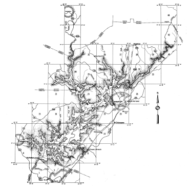
| Please
remember to review your lake map as I continue to see a few people going
over very dangerous structure and timber out there. Please remeber to use
caution for yourself and others. |
|
Everyone
be safe fishing!
Happy
Fishing! :-) |
|
 |
|
Copyright
© 2006-2012.
All
Rights Reserved. |
|
| Contact
Us |
| Copyright
Info |
| Privacy
Policy |
|
 |
|
|
|
|
| Congratulations
to Tim Farley of Lula, GA on his first Walmart FLW win on March 11th, 2006.
Tim is one of the most respected and fierce bass anglers on Lake Lanier
any time of the year. Best of luck in your upcoming tournaments Tim! |
|
|
|
|
|
|
|

|
Welcome
to Lanier Secrets! |
|
Lake
Sidney Lanier is the daily water supplier to local Georgia home and business owners
in the surrounding counties of Gainesville, Cumming, and Buford. Over 3.5 million Georgians
now depend on water stored in the lake or from the Chattahoochee River downstream of
Buford Dam. |
|
| Lake
Lanier also currently supplies the counties and cities downstream (including
Fulton, Cobb and Dekalb counties and the city of Atlanta) with its stored
water sources which are released through the Buford Powerhouse daily. |
|
| In
addition to the water supply to everyone, Lake Lanier, by law, must release
and maintain a minimum flow of water from Buford Dam towards West Point
Lake. By the U.S. Army Corps of Engineers doing so, it will assure a healthy
and safe environment for aquatic and animal life downstream into Florida. |
|
 |
|
| The
lake is extremely popular with boaters, houseboats, jet skiers and others,
particularly around the summer holidays. Over 19 million visitors annually
visit the lake, including the marinas and the Lake Lanier Islands water
park, which was used for the rowing and canoeing events at the 1996 Summer
Olympics. |
|
| Fishing,
boating and camping are the main recreational activities although duck
and goose hunting is allowed in season. Enjoy the best Spot fishing of
the south and visit Lake Lanier soon! Lake Lanier, (officially Lake Sidney
Lanier) is a man-made lake that was completed by the U.S. Army Corps of
Engineers in 1956 with its main purpose to provide for flood protection,
power production, water supply, navigation, recreation and fish and wildlife
management. |
|
| Lake
Lanier completely covers 692 shoreline miles (38,000 acres) across the
counties of Hall, White, Forsyth, Dawson and Gwinnett. In addition there
are 19,000 acres of controlled shore land above 1070 mean sea level. |
|
|
Open
Ramps on Lake Lanier |
|
|
|
|
|
|
 |
Bald
Ridge |
|
Balus
Creek |
|
Big
Creek |
|
Charleston |
|
Chesnut
Ridge |
|
Clarks
Bridge |
|
East
Bank |
|
Gainesville |
|
Holly
Park |
|
Keith's
Bridge |
|
Lower
Pool |
|
Laurel
Park |
|
Little
Hall |
|
Little
River |
|
Mary
Alice |
|
Old
Federal |
|
Sardis
Creek |
|
Shoal
Creek |
|
Six
Mile Creek |
|
Starboard |
|
Sunrise |
|
Thompson
Bridge |
|
Tidwell |
|
Van
Pugh |
|
Vanns
Tavern |
|
War
Hill |
|
Young
Deer |
|
|
|
| For
the most up to date on open boat ramps around Lake Lanier, please visit the Boat
Ramp Calculator page or contact the U.S. Army Corps of Engineers directly. |
|
|
|
Current Lake Level Stats:
|
 |
|
Last Date Updated: |
|
July 03, 2025
|
|
|
|
Last Time Updated: |
|
08:56:34 PM
|
|
|
|
Full Pool Level: |
|
1071.00 |
|
|
|
Current Lake Level: |
|
1072.04
|
|
|
|
|
|

|
|